 Conduct Watershed Analysis or Basin Assessments
Environmental analysis of entire watersheds or basins is often referred to as "watershed analysis" or "basin assessments".
Watershed analysis, developed in the 1990s and early 2000s, often includes the scientific disciplines of hillslope and fluvial geomorphology, fisheries, hydrology, water quality, riparian, roads and mass wasting.
TerrainWorks (NetMap) Digital Landscapes and Tools can be used to create very effective Watershed Analyses or Basin Assessments. For example, see basin assessments using NetMap completed in:
-Upper Sacramento River Watershed Assessment
-Oldman River, Alberta Watershed Assessment
-Clearwater Basin Road Analysis (CFLRP)
In a Watershed Analysis NetMap can be used to:
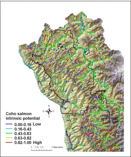
- map fish habitats
- identify biological hotspots
- classify channel types
- map floodplains
- predict instream wood recruitment (riparian management)
- map erosion potential (landslides, debris flows, gully potential)
- quantify sediment supply to streams and rivers
- map sedimentation potential
- calculate channel disturbance potential (restoration)
- conduct a comprehensive road analysis
- and more
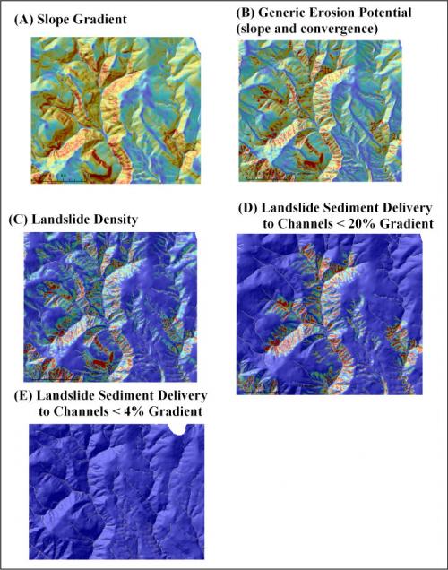
NetMap can also be used to assess various types of erosion potential in a watershed including surface erosion, shallow landslides, debris flows, gullies and earthflows.
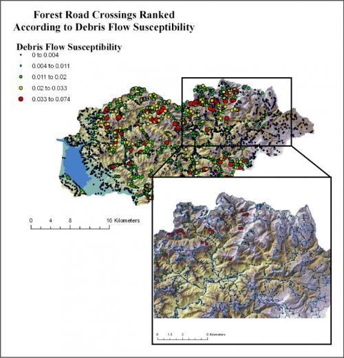
NetMap's road analysis tools include:
- road hydrologic connectivity (drainage diversion)
- road surface erosion
- road stability (shallow landslides)
- road - debris flow risk
- roads in floodplains
- cumulative habitat length above all road crossings
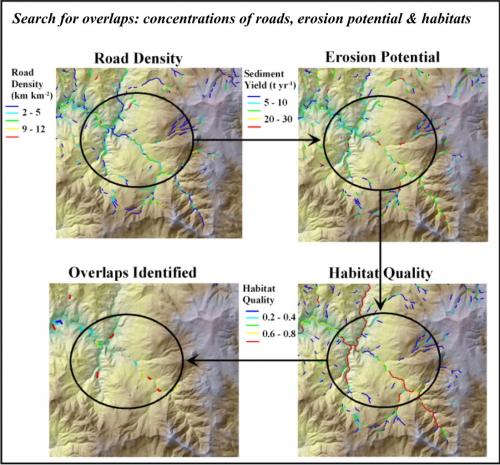
Using NetMap tools, analysts can quickly search for locations of the highest predicted risk factors (top 10% of hillslope erosion, fire risk, road erosion, road stability etc.) and where the top 10% of some risk factor intersects the top 10% of sensitive habitats.
To more fully expore NetMap's tools that could be used in a watershed analysis or basin assessment (either by you, your team, or by us), see the tool lists for:
Examine online Technical Help
See questions TerrainWorks (NetMap) can answer.