TerrainWorks Analyses Reading Room

Arroyo Erosion and Sediment Source Modeling using NetMap (San Francisco Bay Area)
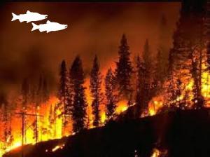
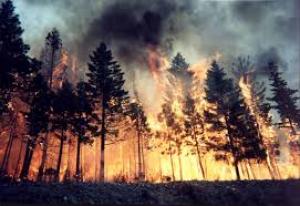
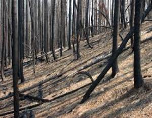
Wildfires and Chinook salmon: Potentially Beneficial Relationships
Fall, 2015 Newsletter - The Pre and Post Fire Issue, Get Informed with Automated Analyses
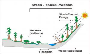
NetMap can be used for automated wetland mapping.

Automated Pre-WIldfire Risk Analysis - Decision Support.
Identify at-risk infrastructure and aquatic/riparian habitats during
pre fire planning and firefighting.
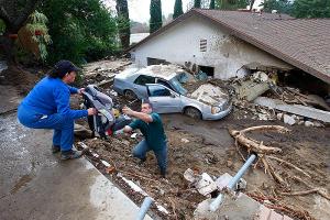
Automatted Post fire Risk Analysis - Decision Support. Identify
at-risk infrastructure and aquatic/riparian habitats following fires, including during
agency Burned Area Emergency Response (BAER) efforts.

Building Virtual Watersheds: A Global Opportunity
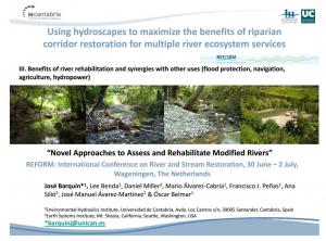
Maximize benefits of riparian zone restoration for multiple river ecosystem services (EU) See paper
Keying forest stream protection to aquatic ecosystem values in multi-ownership watersheds

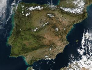
Riparian Zone Delineation in Spain
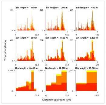
Multi-scale analysis of river networks using the R Package linbin & using
NetMap. See Welty et al. 2015; learn more about linbin and examples.
Using NetMap's virtual watersheds to maximize the benefit of riparian corridor
restoration for multiple ecosystem services. More...
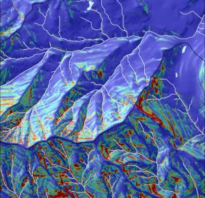
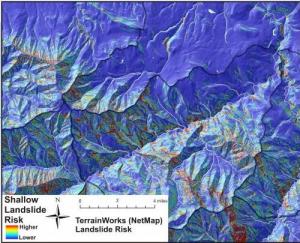
Identifying, quantifying and mapping landslide hazards. Dr. Daniel Miller (ASCE, May 6 2015).

Spring 2015 Newsletter - New Riparian Zone Management Tools

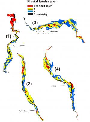
Spatially Explicit, Variable Width Riparian Zone Delineation
See Spring 2015 Newsletter - Highlighting NetMap Riparian Delineation Tools
Landscape Dynamics: Computer generated movies about the role of natural disturbances in ecosystems

Identify the best areas for riparian/fish habitat restoration

Online tool for pre-wildfire decision support

Assessing Vulnerability to Climate Change (northern CA) Southeast Alaska
Moving Beyond Stream Layers: Building Virtual Watersheds
Stream/Biotic Classification Techniques
Latest 2015 NetMap tools for decision support

Watershed Restoration Analysis using NetMap Also, see Presentation Video
See Spring 2015 Newsletter Highlighting NetMap Riparian Tools
Do you use Intrinsic Habitat Potential Modeling, Check this!

Forest Road Analysis - Getting Credit for Existing Improvements and Prioritize Future Actions
Short version video Long version video PPT-PDF

Interested in Thinning in Second Growth Riparian Areas, and Improving Fish Habitats?

Mapping erosion source areas and sedimentation zones, Crystal River, Colorado
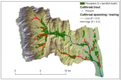
Oldman Watershed, Alberta, Cumulative Watershed Effects Analysis

Modeling Chinook habitat in the Copper River basin, Alaska
Forest Road Assessment, Flathead River, Montana
Upper Sacramento Watershed Assessment: Mixing Fire and Fish
Create a Catchment Scale Perspective of River Restoration (Spain)