 Learn about Landform Process and Form and Ecological Patterns
TerrainWorks Digital Landscapes and Analysis Tools (and the TerrainViewer) can be used effectively in educational settings ranging from high school through university, including in graduate courses.
By having access to Digital Landscapes across large geographic areas that encompass a wide range of physical variability (topography, climate, river networks, coast lines), teachers and students, using the analysis tools, can investigate many types of landscape features that drive physical landform processes as well as ecological processes.
Learn how topography and climate drives erosion processes and rates of sediment production.
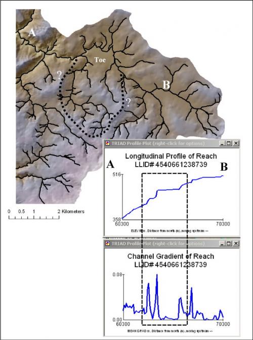 Learn how to detect the signatures of deep-seated landslides and earthflows.

Learn about how basin shape influences network geometry and the types and distribution of tributary confluence efffects.
 Learn about floodplain development and how it contributes to riverine habitats and habitat diversity.

Learn about the formation and spatial distribution of floodplains, terraces and alluvial fans and how they influence river networks and the formation of riverine habitats.
Conduct comparative analyses across entire landscapes, states and regions. Explore how geology controls topography and river networks, and thus the types and distributions of salmonid habitats.
Learn about: