TerrainWorks (NetMap) Synthetic Stream Layer
 Download Stream Layers for specific Hydrologic Unit Code 4 (8 digit) basins.
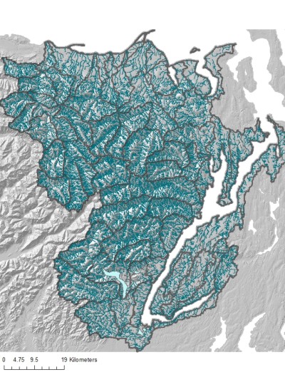
TerrainWorks (NetMap) creates and utilizes a "synthetic" stream layer built using DEMs and computerized flow routing algorithms.
NetMap's synthetic stream layer is routed, liberally densified (e.g., capturing headwaters) and is consistent across large geographic areas. Reach lengths typically range between 100 and 200 m. The synthetic stream layer contains several reach attributes including ID, elevation, drainage area, and Strahler (1952) stream order.
To access the full attributed stream layer, digital hydroscape and analysis tools, go here.
How is the Synthetic Stream Layer Built ?
How does it differ from the NHD?
The NHD is a valuable data source and NetMap's synthetic stream layer uses it to help guide channel locations in areas of low relief and low gradient. A cross talk tool (planned) will provide data transfer between NetMap's synthetic layer and the NHD.
To get the full power out of NetMap's synthetic stream layer either get the packaged Watershed Assessments or NetMap tools coupled to the full Digital Hydroscape; users gain access to more than 100 parameters.