 Delineate Floodplains & Flood-Prone Areas
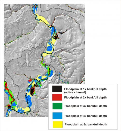
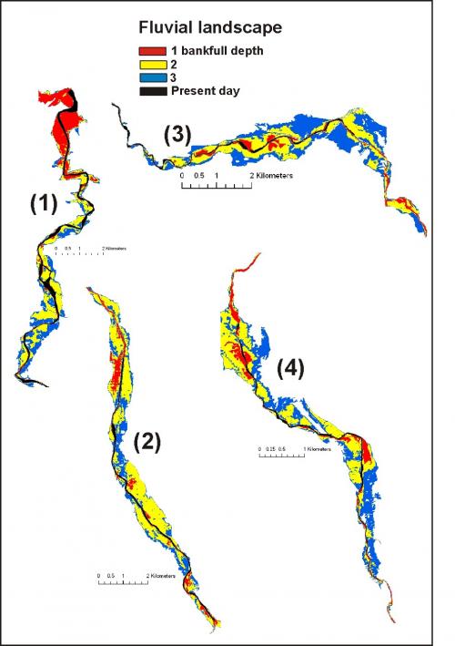
NetMap utilizes digital elevation models to determine valley floor elevations relative to channel elevations. Map floodplains at mutliple elevations to determine relative risk of flooding and to identify varying terrace levels. For example, surface elevations equivalent to one multiple of bankfull depth will identify active channels; 2 multiples of bankfull depth is the active floodplain; 3 and 4 multiples might be historical (abandoned) floodplains.
Accurately delineating floodplains and flood prone areas is important for protecting ecologically sensitive areas and to mitigate against flooding damage to infrastructure including roads, pipelines and buildings. Floodplains include riparian areas that are one of the most ecologically valuable parts of landscapes.
Map Historical Floodplains
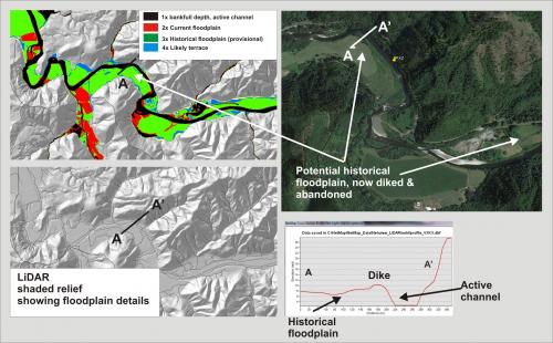 Floodplains can be abandoned by diking, agriculture, channel dredging and channel incision. Use NetMap's floodplain mapping tool to identify these areas, potential sites for channel-floodplain restoration.
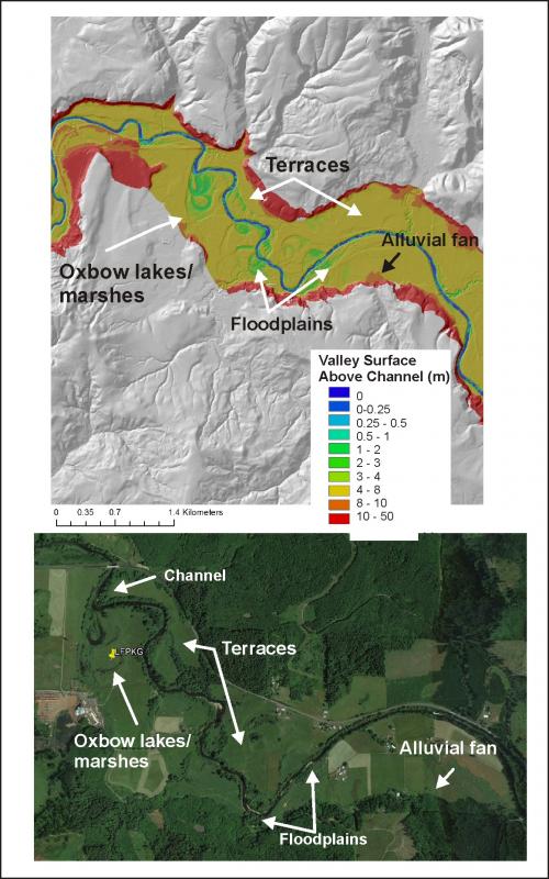 Map Floodplains, Terraces and Fans
Identify terraces at variable heights above the channel, including flooplain features such as oxbow lakdes and alluvial fans.
Identify Constrained and Unconstrained Valley Floors
Identify variable valley floor morphology including constrained and unconstrained sections. This can have implications for cold water refugia using another NetMap tool.
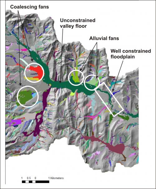
Map areas of coelescing alluvial fans and terraces using NetMap. Combine predictions of alluvial fan locations with NetMap's debris flow tool to locate areas of higher risk during storms and following wildfires.
Floodplains and River Restoration
Use floodplain mapping to develop watershed scale perspectives of river restoration; to see an application in Spain, go here.
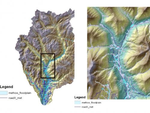
Overlay onto Google Earth
Overlay predicted polygons of floodplains onto Google Earth to examine spatial patterns of floodplains and their relationship to land use patterns.
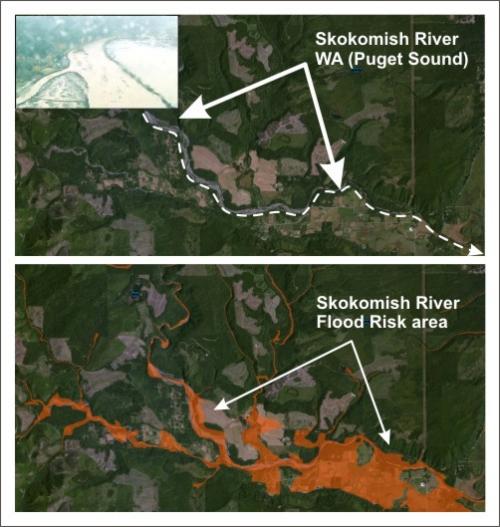
Floodplains and Roads
Once floodpains are mapped, search for roads within flood prone areas.