Use NetMap Technology to Map and Characterize Estuaries
 TerrainWorks (NetMap) technology was applied to mapping estuaries in the Puget Sound. A merged bathymetery-terrestrial DEM was used in conjunction with a model to predict annual cycles of tides thereby providing a prediction of inundation.
Estuary mapping is not yet a tool in NetMap. Our staff is available to apply these tools in different areas: contact us.
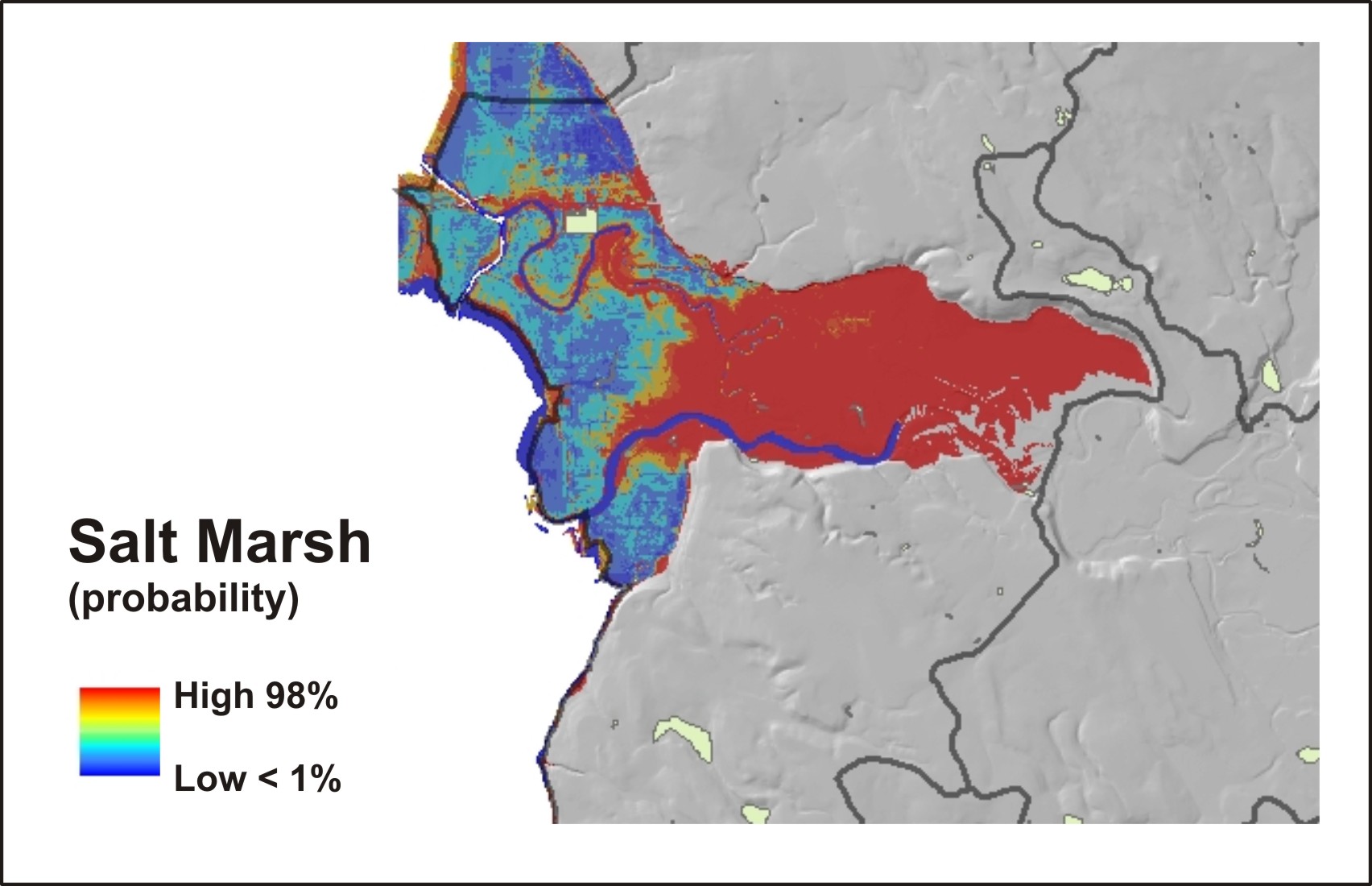
Next, a model was built to use the predicted proportion of annual inundation and create a estuary classification system (salt marsh, mudflats). More complex classifications are feasible.
To learn more about this approach, go here.
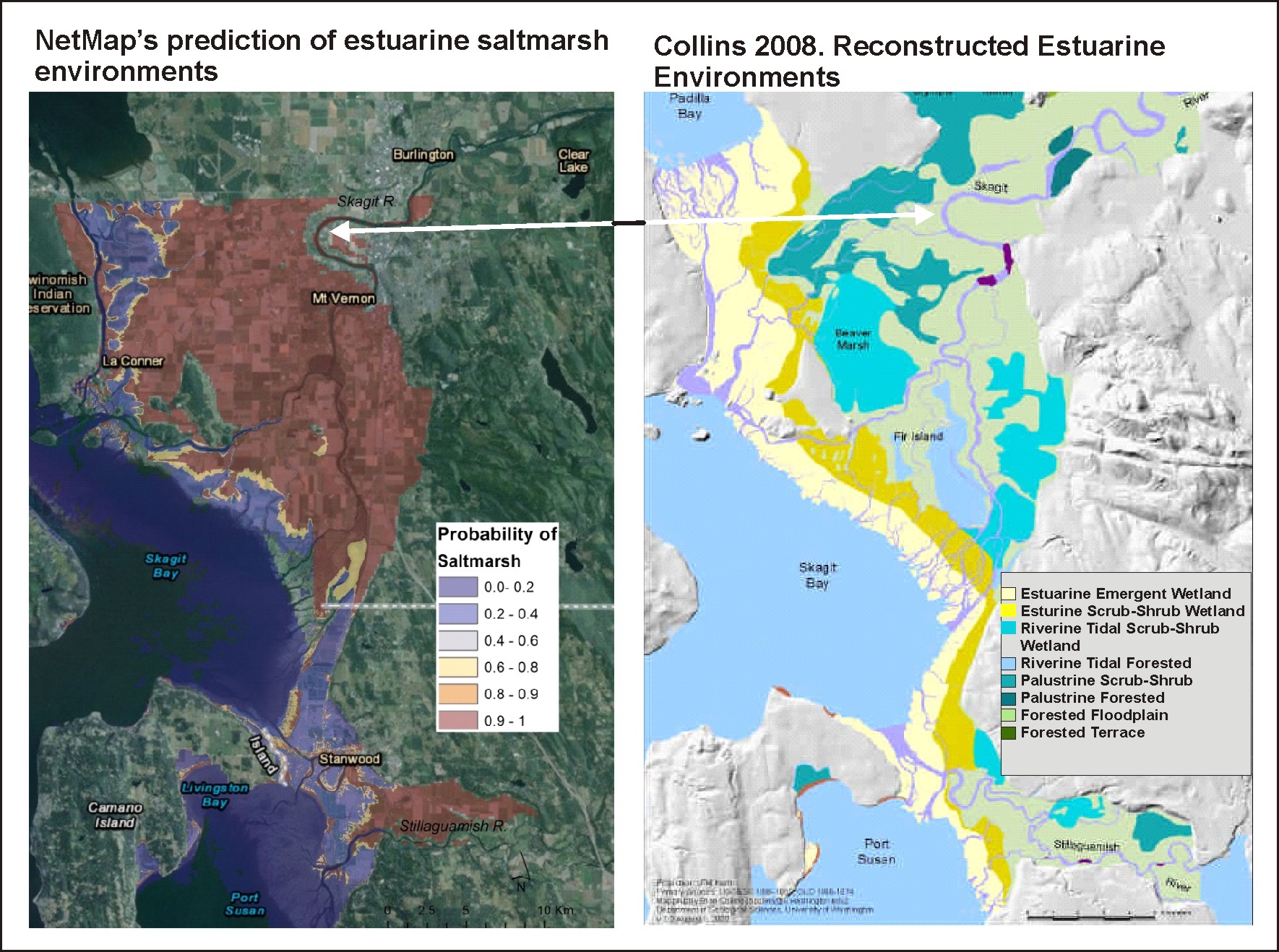
Here are more examples in the Puget Sound, and in comparison to historical data and field mapping of estuaries.
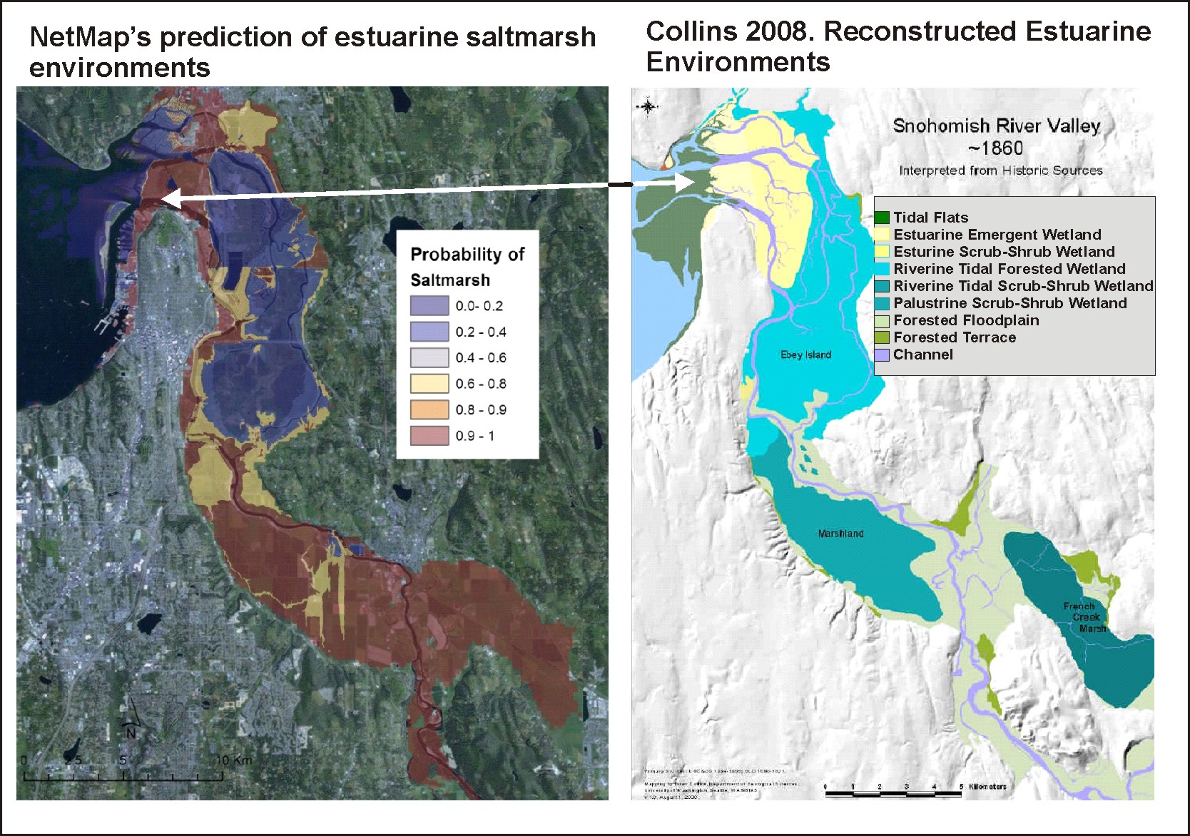
See more details about estuary mapping here.
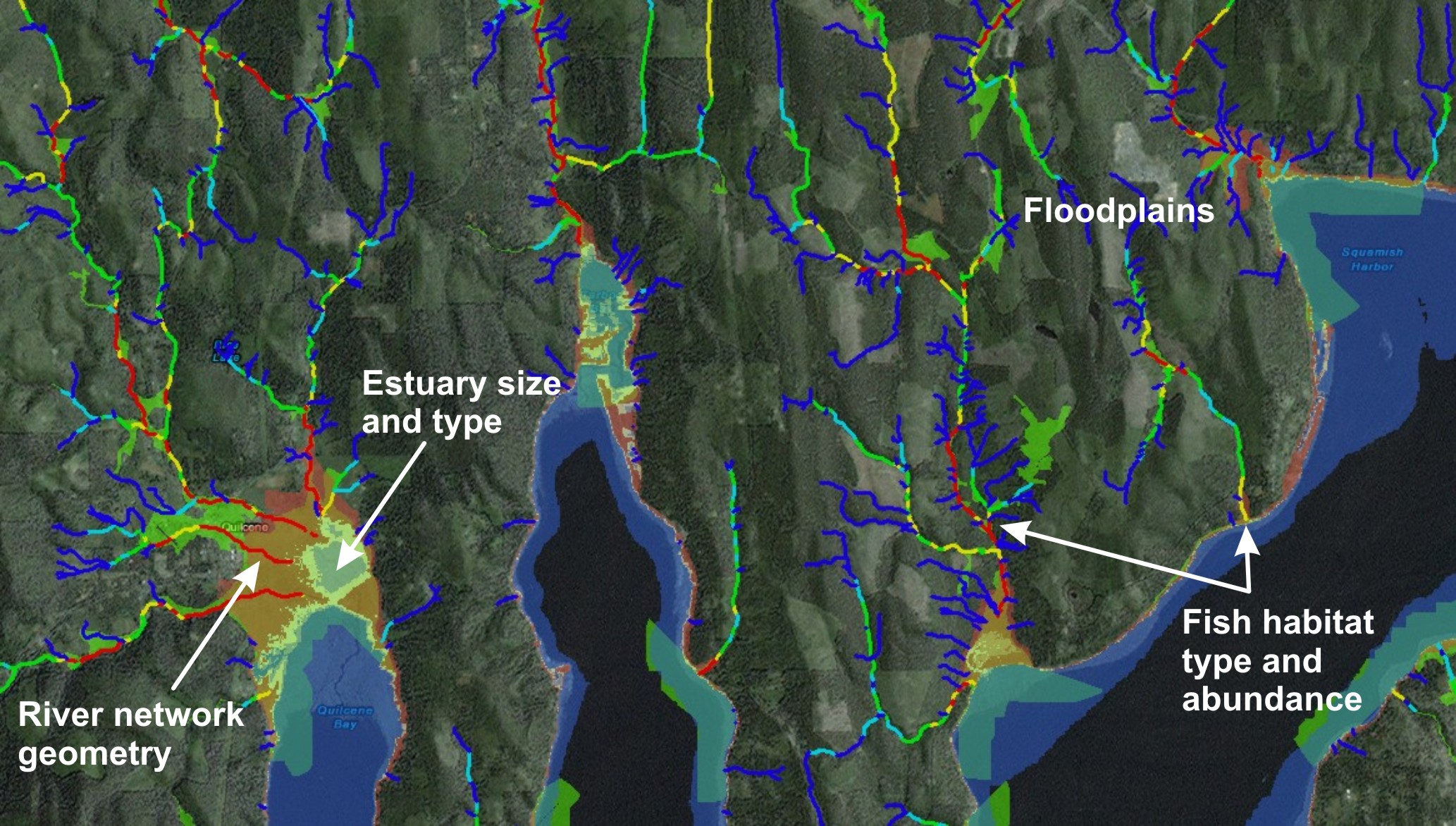
Mapping of estuaries (in places like the Puget Sound) could be used to develop unique ecological classification schemes that couple estuary type and extent with floodplains and salmonid habitats.
A different technology was used to map estuaries in southeast Alaska where lower resolution DEMs and fewer tidal gauges preclude the accurate digital elevation mapping.
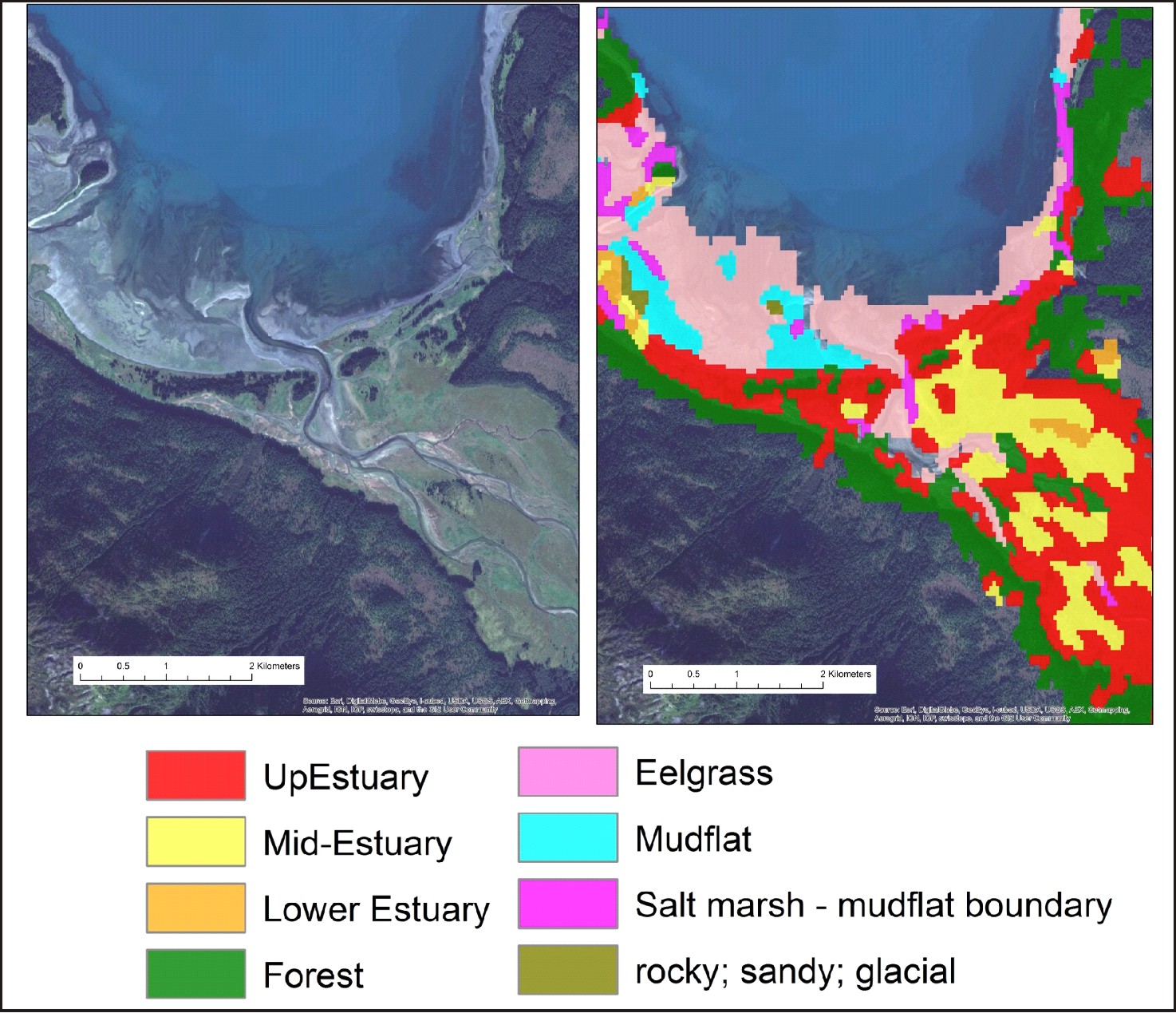 In conjunction with Colorado State University, Landsat 8 imagery was used to delineate different types of estuary vegetation cover.

