If you have NetMap tools that contain the latest floodplain mapping technology and access to NetMap's datasets, either built using 10 m DEMs or using LiDAR, see the steps below to update your habitat intrinsic potential maps to make them more accurate.
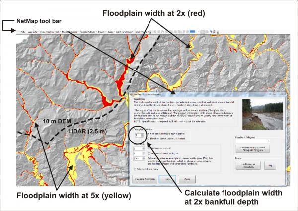 The first step is to open NetMap tools, load a dataset, and then run the floodplain tool to calculate floodplain width at two times bankfull depth (2x); typically NetMap datasets will come with this parameter by default, but just to make sure, you should rerun the floodplain mapping tool.
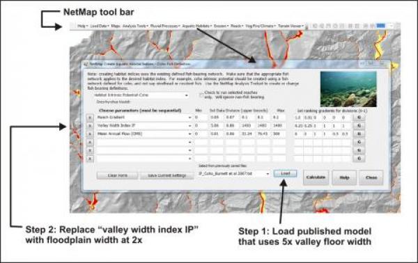 The next step is to use the new floodplain width at two times bankfull depth in calculating a revised habitat intrinsic potential (for coho salmon and steelhead trout, specifically).
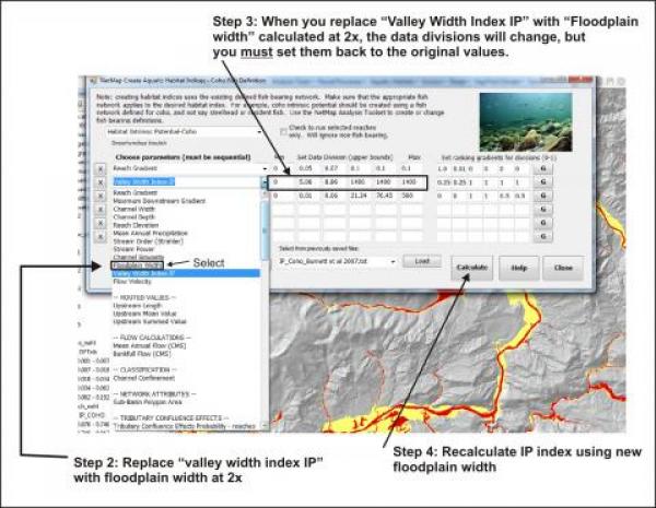 Use the drop down list to locate the floodplain width attribute, load it, and then make sure you reset the data divisions to where they were before.