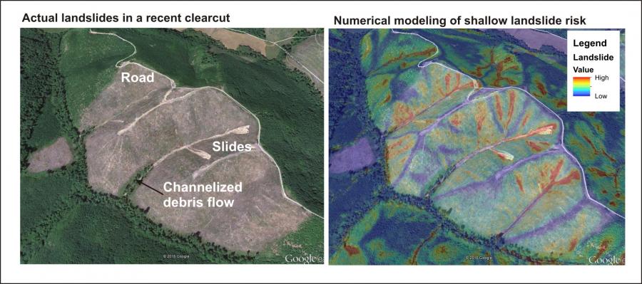
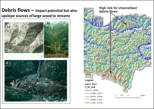
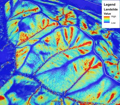
Use of high resolution LiDAR digital elevation models greatly improves the mapping of landslide and debris flow potential.

Individual landslide sites can be readily identified. Associated debris flow risk can also be mapped accurately using LiDAR DEMs.

