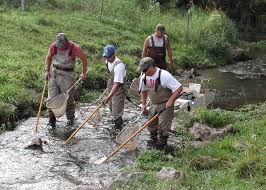
 The US Geological Survey, Forest and Rangeland Ecosystem Science Center (Ecosystems Program, Northwest Region) is using NetMap to support development of landscape models of stream metabolism, stream temperature and stream fish assembledge structure. Areas of focus include western Oregon, the Middle Fork of the Salmon Basin in Idaho and the Olympic Peninsula in Washington State.
In addition, NetMap tools will be used in support of graduate research and for Department of Interior Partners (Bureau of Land Management and National Park Service).
