 NetMap is being used in a variety of applications by the US Forest Service in Region 6 (17 national forests in Washington and Oregon). Applications include designing site specific riparian management of second growth forests (thinning), road (transportation) analysis, timber harvest and climate change vulnerability assessments.
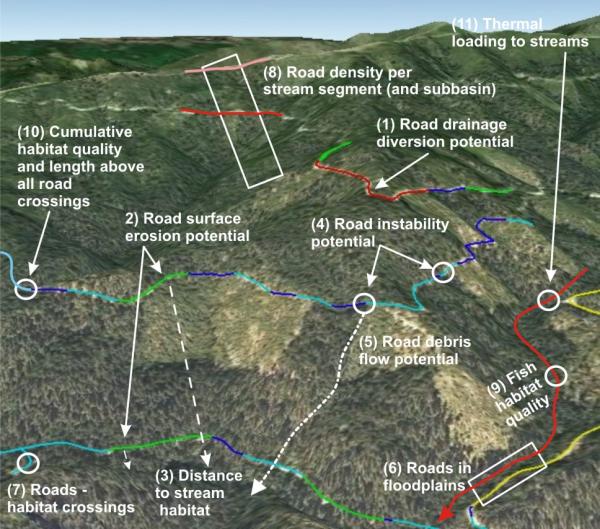
 NetMap road tools include:
- road density (subbasin and stream reach scale)
- road drainage diversion (hydrologic connectivity)
- road surface erosion potential
- road stability
- roads and debris flows
- cumulative habitat length and quality upstream of road crossings
- road - habitat intersections
