
US Forest Service - Region 1 (12 national forests), Montana, Idaho: Watershed Management
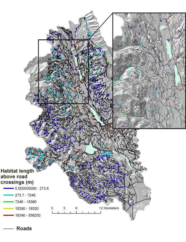
The U.S. Forest Service, Region 1 requested NetMap coverage (Digital Landscapes and Analysis Tools) for all 12 national forests in western Montana and Idaho. National forests in Region 1 are applying NetMap for transportation related analyses (often referred to as “minimum roads”, subpart A). NetMap’s road tools include: road density (subbasin and drainage wing/reach segment scales), road hydrologic connectivity (diversions), road surface erosion, road stability, cumulative habitat above all road crossings, and habitat-road classification; fish modeling is also applied.
 Region 1 national forest can also use NetMap
for pre-wildfire planning and
post-fire (BAER) response.