The Nature Conservancy: Matanuska – Susitna (Mat-Su) River Basin, Alaska: Basin Planning
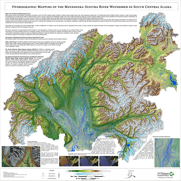
The Nature Conservancy commissioned NetMap coverage in the entire Mat-Su River basin (60,000 km2) in support of expanded salmon habitat mapping and related decision support tools for urbanization and other dispersed land uses. The MatSu-NetMap project is being coordinated by TNC and other partners of the Mat-Su Salmon Habitat Partnership. The Digital Landscape, inclusive of a synthetic stream layer, is being built using 5 m IsFAR DEMs (SDMI), merged with submeter LiDAR along the main valley floors.
Using TerrainWorks NetMap technology, the mapped extent of the MatSu River network increased by 28,000 miles of channels, doubling the miles of streams and rivers! See news release (Feb. 16, 2016). TerrainWorks paper on channel delineation technology.
Working in conjunction with St. Marys University (MN) and TNC, TerrainWorks MatSu River network will become the NHD update.
See a higher resolution version of the Mat-Su river network map (The Nature Conservancy-Mat-Su Basin Salmon Habitat Conservation Partnership).
 The TNC Mat-Su NetMap project aims to build a strategy to integrate new Alaskan DEMs (SDMI) and the building of a Digital Landscape with Analysis Tools and link to efforts to enhance a new Alaskan hydro later (AK Hydro) and to update the NHD+.
