TerrainWorks Environment Assessments that are Economical and Easy to Understand are Comprised of Three Elements:
1) Directional hazard maps,
2) Compounded (overlapping) hazards and
3) Hazard Neighborhoods.
(1) Easy to Interpret Directional Hazard Maps using the Highest Resolution Digital Data Available. Five examples are provided below:
i) wildfire, ii) flood, iii) landslide, iv) mudflow and v) climate change.
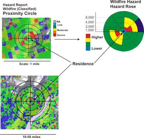 (i) Wildfire:
Wildfire severity and likelihood are analzed at multiple spatial scales targeting individual properties or communities.
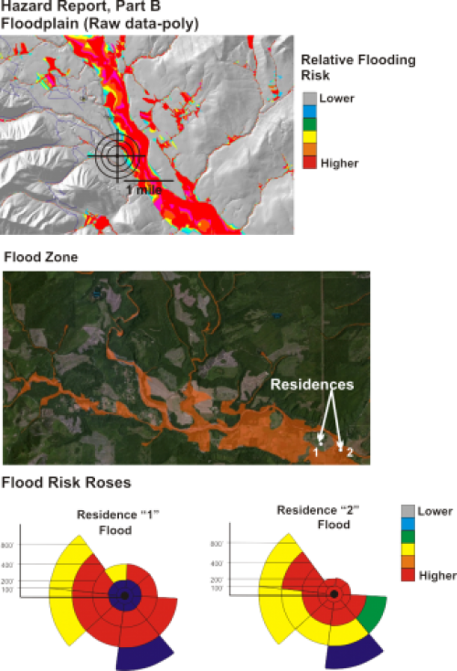 (ii) Flooding Risk.
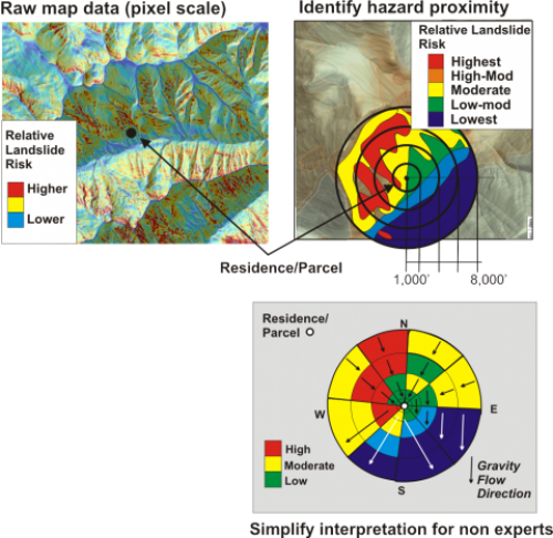 (iii) Landslide.
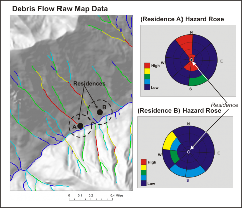 (iv) Mudflows.
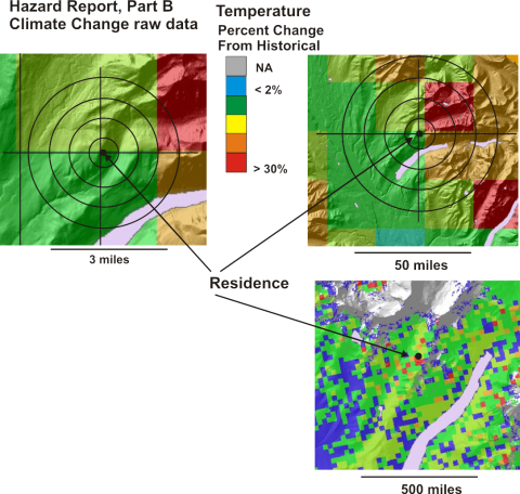 (v) Climate Change
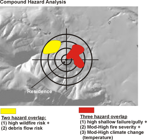 (2) Compounded Hazards:
Compounded or overlapping hazards refers to the hazards that overlap one another, spatially, that can lead to greater exposure to natural hazards.
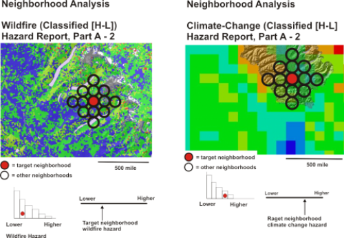
(3) Hazard Neighborhoods:
Send Us Your Location (anywhere in the U.S.) and Get a Cost Quote - Contact us.
Note, because of lack of data and an incomplete scientific information, not all hazards will be identified or accurately characterized.
