NetMap: Community Based Tools
By developing and distributing customizable and adaptable Virutal Watersheds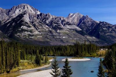 , coupled to tools, TerrainWorks provides the platform in which agencies and other groups partake in considerable cost savings in accessing state of the art science and technology. Community tools means that when someone funds a new tool or tool upgrade in one geographic area, it is made immediately available to all TerrainWorks users in all areas. Such community tool building requires a consistent watershed databases of common numerical structure.
NetMap is consistent with "The Future of Applied Watershed Science at Regional Scales".
Compatibility with NHD/NHDplus
The NHD and NHDplus can be an important resource in certain state and federal agencies. NetMap is very similar in concept to the NHDplus, but has aspects that provide additional utility and specificity (think NHDplus on steroids). Thus it is important that NetMap be able to cross talk with the NHD and NHDplus. In some areas, such as Alaska, TerrainWorks in conjunction with organizations like The Nature Conservancy, is creating new NHDplus from NetMap directly. Read more about NHD/NHDplus compatibility here.
Consistency but Flexibility
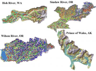
The building of community analysis tools that can be shared by numerous diverse users in agencies, NGOs, universities and the private sector requires a common digital infrastructure that we refer to as a “Virtual Watershed”. A virtual watershed consists of a digital terrain model where terrestrial and riverine surfaces are characterized and connected along physically and biologically relevant pathways. A common numerical and programming structure allows tools that are built in one area (Puget Sound, Washington) to be applied to other areas (California or Alaska).
Access to a consistent virtual watershed allows users in different locations and with different concerns to quickly access similar types of information in a consistent format. In addition, the use of uniform tools that analyze dissimilar watersheds in similar ways can promote common methodologies, vocabularies, and problem-solving techniques, serving to increase communication and collaboration within and among agencies and stakeholders. This can be of considerable value to agencies and NGOs that are involved with planning at large spatial scales.
However, unlike systems that depend on a static, delimited set of stream lines and associated catchments, NetMap's synthetic river networks and virtual watersheds are customizable and adaptable to meet the needs of diverse analysis and decision support.
Social Networks, NetMap and Access to Best Available Science

The science community in universities and government research labs is the primary generator of new science and technologies. However, social network analyses reveal that scientists communicate primarily with one another via conferences, journals and research collaborations, and they communicate very little with the applied science part of their disciplines. Thus, much of the applied science community working in agencies, NGOs and the private sectors that are not academically networked can fall behind in science and technology. This is particularly serious for resource use and conservation planners.
TerrainWorks is designed to incorporate the latest science and technologies into easily accessible tool and technical help formats that help practitioners in the applied natural resource sciences to stay up to date and networked in to the best available science.
Relax, Your Technology is Supported
Because of the rapidly evolving environment of science, technology, computer models and other commercial software and the increasing availability of new digital data, a system of community based digital landscapes and analysis tools must be constantly upgraded and supported. Conventional funding from government agencies and NGOs is not designed to provide long term maintenance and support of software and database systems, like TerrainWorks. Thus TerrainWorks provides up to date virtual watersheds and analysis tools, accessed by 'NetMap as a Service' and by annual license, similar to other software.