 Map Erosion Sources/Calculate Sediment Budgets
Mapping erosion source areas and predicting sediment supply to streams, rivers and reservoirs is useful in resource use planning and risk mitigation. Analysis of the sources, transports and sinks of sediment on hillsides and in rivers (sediment budgeting) has numerous applications in forestry, restoration, fishery management, wildfire planning, urban planning, watershed management, grazing, climate change and energy (and hydropower) development.
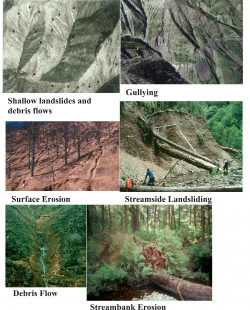
NetMap's erosion prediction tools include:
- shallow landslide
- gullying
- debris flow
- surface erosion
- Earthflows/deep seated
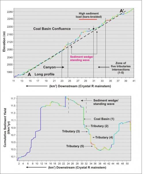
See example application in Colorado.
SHALLOW LANDSLIDING
NetMap's shallow landslide model uses a topographic index combining drainage area per unit contour length, convergence and hillslope gradient. The topographic index can be calibrated to local conditions using landslide inventory data. 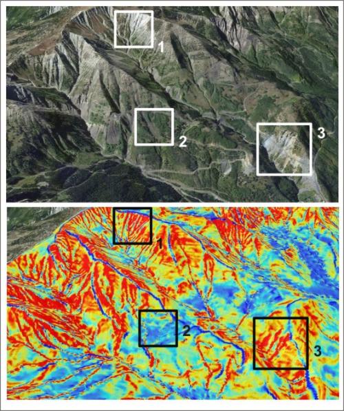 Go here for more details.
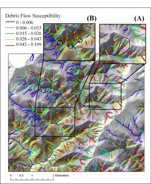
DEBRIS FLOW
NetMap's debris flow model uses landslide susceptibility (number per unit area) at the heads of first-order channels, channel gradient, valley confinement and tributary junction angles. For more information, go here.
Surface Erosion
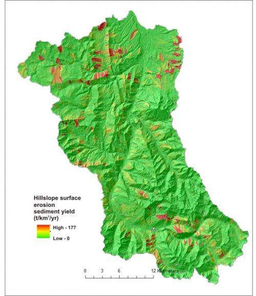
NetMap uses the WEPP surface erosion model. The Disturbed WEPP model predicts surface erosion and sediment delivery to streams and it can also be used to predict erosion following wildfires.

Gullying
NetMap's gully erosion tool uses specific drainage area and hillslope gradient and curvature. For more information, go here.
Link Erosion and Sediment Yield to Channel Environments
All erosion predictions are reported to streams via NetMap's Drainage Wings. Channel eye views of erosion allows analysts to examine the spatial variability in sediment supply that can be related to channel sedimentation patterns. See example.
Classify Erosion/Sediment Sources at Scale of Subbasins
 All NetMap's erosion predictions, either on the hillside or in the channel, can be summarized at the scale of subbasins.