 Create Customized Digital Landscapes (boundaries, size etc.).
Contact us for additional details and a cost estimate.
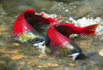
Individual NetMap's Digital Hydroscape datasets are generally available at the scale of Hydrologic Unit Code (HUC) 4th level (8 digit) across the coverage area. HUC 4 NetMap datasets average in area approximately 500,000 acres (2000 square kilometers, 800 square miles). NetMap's HUC 4 datasets enable computationally intensive NetMap calculations (thermal load, floodplain mapping, surface erosion, road erosion, road stability etc.) to be carried out in a timely fashion on user's desktop computers.
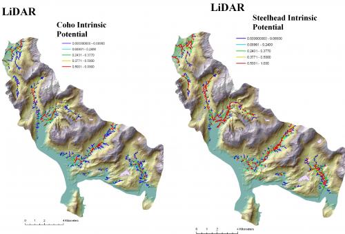
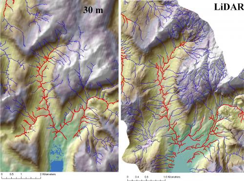
In addition, NetMap's HUC 4 datasets are generally built using 10 m DEMs (NED); finer resolution datasets (LiDAR or LiDAR-10m composites) are available in certain areas, particularly near urban settings or in certain parts of Alaska. Contact us about their availability.
However, agencies, NGOs, and other clients may require customized datasets to more closely match project, watershed, jurisdictional or ownership boundaries. In addition, NetMap datasets can be built using new (often higher resolution) DEMs or even proprietary DEMs. Such customized datasets can be proprietary to the client.
Please contact us for additional details and a cost estimate.